Wisdom English Learn about the world. Grow your English.
Science, Tech & Future

How GPS Finds Your Location

A1 A2 B1 B2

GPS feels like magic, but it is “time + distance + several satellites.” Learn the simple steps and why your phone’s blue dot sometimes drifts in cities or indoors.

A1 Level

GPS helps your phone find you on a map.

The Blue Dot That Follows You

GPS helps your phone find you on a map.

Jun is a tourist in a new city. The street is busy. Cars pass by. People walk fast. Jun wants to go to a museum, but he is not sure which way to go.

He takes out his phone. He opens a map app. He sees a small blue dot. The dot is his location. When he walks, the dot moves. When he stops, the dot stops. Jun feels calm again.

How does the phone know? GPS helps. GPS uses satellites in the sky. Satellites send signals. The phone listens to these signals. Then the phone can show Jun’s place on the map.

GPS is very helpful. It can help you find a café, a bus stop, or a hotel. But GPS is not perfect. Sometimes the signal is weak. In a tunnel or inside a building, the phone may not “hear” the satellites well. Then the blue dot can move to the wrong place for a short time.

Jun steps into an open area. The dot becomes clear again. He smiles and keeps walking. Technology can guide us—but we still need to look around, too.


Key Points

  • GPS uses satellites to help your phone show your location.
  • GPS can be less accurate inside buildings or tunnels.

Words to Know

GPS /ˌdʒiː piː ˈɛs/ (n) — a system that helps find your location
satellite /ˈsætəˌlaɪt/ (n) — a machine that orbits Earth in space
signal /ˈsɪɡnəl/ (n) — a message sent through air or space
map /mæp/ (n) — a picture of places and roads
location /loʊˈkeɪʃən/ (n) — where you are
sky /skaɪ/ (n) — the space above the Earth
tunnel /ˈtʌnəl/ (n) — an underground road or path
move /muːv/ (v) — to change position


📝 Practice Questions

A1 – True/False

  1. GPS uses satellites to help your phone find your location.
  2. GPS works best inside tunnels.
  3. The blue dot can move when you walk.

A1 – Multiple Choice

  1. What does Jun see on his map app?
    A. A blue dot
    B. A red triangle
    C. A green square

  2. Where can GPS be less accurate?
    A. In a tunnel
    B. In an open park
    C. Under a clear sky

  3. What do satellites send to the phone?
    A. Signals
    B. Shoes
    C. Paper maps

A1 – Short Answer

  1. What color is the dot?
  2. What helps the phone find you?
  3. Name one place GPS can be weak.

A1 – True/False

  1. True
  2. False
  3. True

A1 – Multiple Choice

  1. A
  2. A
  3. A

A1 – Short Answer

  1. Blue
  2. GPS
  3. Tunnel / inside a building (any one)
A2 Level

Your phone listens for time signals from space.

Why GPS Needs the Sky

Your phone listens for time signals from space.

Sara and her friend stand outside a subway station. They want a small restaurant nearby. Sara opens her map app, but the blue dot is slow. It spins and spins. Tall buildings are all around them.

GPS works with satellites above Earth. These satellites send signals with very exact time. Your phone receives the signals. Then it uses the travel time to guess distance. A simple idea is this: if a signal takes longer to arrive, the satellite is farther away.

With more than one satellite, the phone can narrow the answer. One satellite gives a wide “area.” Several satellites help the phone find one clearer point. That is why GPS can feel fast in an open park but slow in a crowded city street.

Experts at NASA explain that GPS signals are very weak by the time they reach the ground. So buildings, mountains, and indoor spaces can block them. Sometimes signals also bounce off walls, and the phone gets a confusing message.

Sara walks a little toward an open corner of the street. The dot becomes steadier. She laughs and says, “The sky helps.” GPS is amazing—but it works best when your phone can “see” the sky.


Key Points

  • GPS uses time signals to estimate distance from satellites.
  • Open sky usually means faster and more accurate GPS.

Words to Know

receive /rɪˈsiːv/ (v) — to get something sent to you
time /taɪm/ (n) — seconds and minutes; here, exact timing
distance /ˈdɪstəns/ (n) — how far something is
accurate /ˈækjərət/ (adj) — correct and close to the true value
block /blɑːk/ (v) — to stop something from passing
bounce /baʊns/ (v) — to hit and reflect back
corner /ˈkɔːrnər/ (n) — where two streets or lines meet
update /ʌpˈdeɪt/ (v) — to make new and current
station /ˈsteɪʃən/ (n) — a place for trains or subways


📝 Practice Questions

A2 – True/False

  1. GPS uses signal travel time to guess distance.
  2. Tall buildings can make GPS slower or less accurate.
  3. GPS signals are stronger inside buildings than outside.

A2 – Multiple Choice

  1. Why does open sky help GPS?
    A. The phone can hear satellites better
    B. The phone battery lasts longer
    C. The map becomes bigger

  2. What can happen near tall buildings?
    A. The dot becomes slow or wrong
    B. The phone becomes waterproof
    C. The street becomes quieter

  3. What idea connects time to distance in GPS?
    A. Longer travel time means farther away
    B. Faster walking means stronger signal
    C. More apps means better accuracy

A2 – Short Answer

  1. Why is Sara’s GPS slow at first?
  2. What does Sara do to help GPS work better?
  3. What is one simple tip for better GPS?

A2 – True/False

  1. True
  2. True
  3. False

A2 – Multiple Choice

  1. A
  2. A
  3. A

A2 – Short Answer

  1. Tall buildings block weak signals
  2. She moves to an open area
  3. Step to open sky / avoid tunnels (any one)
B1 Level

The system is smart, but the signals are fragile.

When GPS “Jumps” in the City

The system is smart, but the signals are fragile.

A driver is in a hurry in a big city. Tall buildings rise on both sides like a canyon. The map voice says, “Turn left,” but the blue dot suddenly jumps to a street behind him. For ten seconds, the phone looks “lost.” Then it fixes itself.

Time Becomes Distance

GPS satellites send signals with time stamps. Your phone measures how long each signal took to arrive. Because radio signals travel extremely fast, a tiny time difference can change the distance result. Engineers often explain it like this: the phone is measuring “how late” the signal is.

More Satellites, Clearer Position

One satellite gives one distance. That distance makes a big circle around the satellite. Add a second and third satellite, and the possible place becomes smaller. With four or more satellites, the phone can improve accuracy and also correct a small time error inside the phone’s receiver. This is why GPS can feel better after a short wait.

Why Buildings and Tunnels Cause Trouble

In a “city canyon,” signals can be blocked. Or they can reflect off glass and concrete and arrive a bit late. That late arrival can trick the phone into thinking you are farther away. Then the dot drifts or jumps. Researchers at universities, including aerospace departments, study these signal problems because they matter for safety and navigation.

On an open highway, the same phone often works perfectly. The lesson is simple: GPS is strong when the sky is open, and weaker when signals are blocked or bounced. If your dot looks strange, give it a moment—and if you can, move to a clearer spot.


Key Points

  • GPS turns signal travel time into distance, then calculates your position.
  • Four or more satellites usually improve accuracy and help fix time error.
  • Cities, tunnels, and reflections can make the blue dot drift or jump.

Words to Know

receiver /rɪˈsiːvər/ (n) — a device part that catches signals
calculate /ˈkælkjəˌleɪt/ (v) — to find an answer using steps
position /pəˈzɪʃən/ (n) — your exact place
narrow /ˈnæroʊ/ (v) — to make smaller or more specific
reflect /rɪˈflɛkt/ (v) — to bounce back from a surface
error /ˈɛrər/ (n) — a mistake or wrong result
drift /drɪft/ (v) — to move slowly away from the right place
canyon /ˈkænjən/ (n) — a deep space between high sides (here, buildings)
lock /lɑːk/ (n) — the moment GPS connects well and becomes stable
orbit /ˈɔːrbɪt/ (n) — the path a satellite travels around Earth
constant /ˈkɑːnstənt/ (adj) — happening again and again


📝 Practice Questions

B1 – True/False

  1. Four or more satellites can help fix a time error in the receiver.
  2. Reflected signals can arrive late and confuse the phone.
  3. GPS always gives perfect results in every place.

B1 – Multiple Choice

  1. What does the phone measure to estimate distance?
    A. Signal travel time
    B. Screen brightness
    C. Battery temperature

  2. What is a “city canyon” in the article?
    A. Tall buildings on both sides
    B. A wide open desert road
    C. A tunnel under a river

  3. Why can the dot “jump” in a city?
    A. Signals are blocked or reflected
    B. Satellites stop moving
    C. Maps delete streets

B1 – Short Answer

  1. Why do more satellites usually help GPS?
  2. What can reflections do to a GPS signal?
  3. Where does the same phone often work better?

B1 – True/False

  1. True
  2. True
  3. False

B1 – Multiple Choice

  1. A
  2. A
  3. A

B1 – Short Answer

  1. They narrow to one position and improve accuracy
  2. Make it arrive late and cause errors
  3. On an open highway / open sky
B2 Level

Location feels simple, but the system behind it is huge—and delicate.

GPS: A Global Clock System in Your Pocket

Location feels simple, but the system behind it is huge—and delicate.

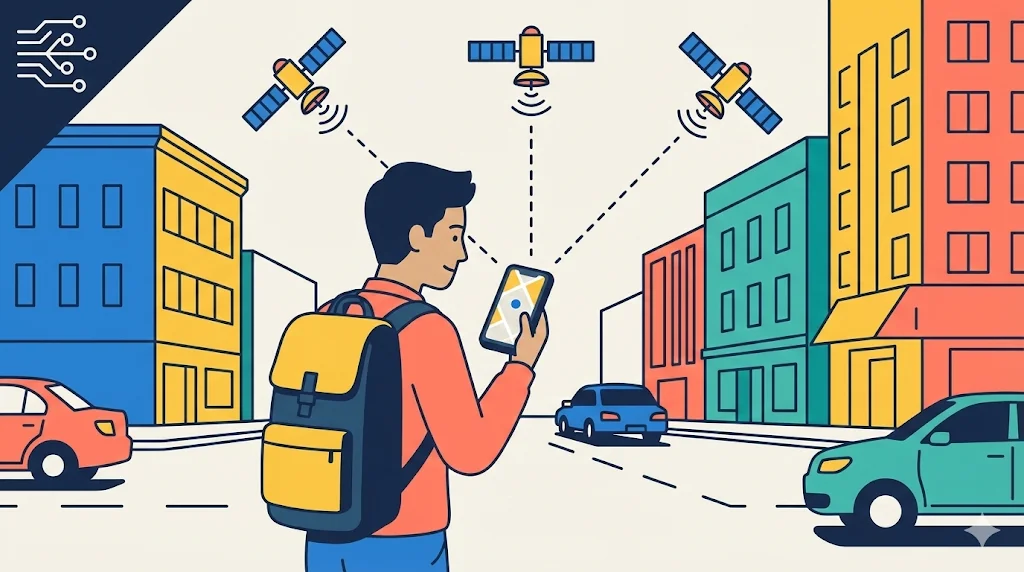
A delivery worker starts the day with a full list of stops. The phone is always on: “Next address, 2 minutes.” In open areas, the blue dot is steady. In dense city blocks, it drifts. One wrong turn means a late package, a stressed customer, and a longer day. GPS saves time—but it also adds pressure when it fails.

The Core Trick: Time → Distance → Position

GPS works because satellites carry highly accurate clocks and broadcast time-stamped signals. Your phone compares the satellite time to its own time and measures the travel time. Travel time becomes distance because the signal moves close to the speed of light. With several distances at once, the phone solves for one position on Earth. This method is often called trilateration (finding a point using distances, not angles).

Why Errors Happen: Weak Signals and “Multipath”

GPS signals are faint at ground level. In tunnels, indoors, or under heavy trees, the phone may not receive enough clean signals. In cities, signals can bounce off buildings and arrive by a longer path. This is called multipath. The phone thinks the satellite is farther away than it really is, so your dot shifts. Add small clock errors and noisy conditions, and accuracy changes minute by minute.

Assisted GPS and Modern Dependence

Many phones use “assistance” to start faster, often called A-GPS. The phone may use cell towers or Wi-Fi hints to get a quick first estimate, then refine it with satellites. Technology writers, including those at IEEE Spectrum and MIT Technology Review, often point out that navigation is now part of daily infrastructure: ride-share pickups, emergency services, shipping, farming, aviation, and even banking security can depend on location and timing.

That power brings a risk, too. Location data can reveal routines—home, work, habits, and meetings. So GPS is not only a convenience tool; it is also sensitive information. The blue dot feels personal, but it is built on a global network above our heads. Understanding its limits helps us plan calmly, double-check in difficult places, and treat location data with care.


Key Points

  • GPS is a time-based system: signals + timing become distances and a position.
  • Multipath (signal bouncing) and blocked sky view can reduce accuracy in cities.
  • Modern life depends on location systems, so privacy and reliability both matter.

Words to Know

trilateration /traɪˌlætəˈreɪʃən/ (n) — finding a point using distances
multipath /ˈmʌltiˌpæθ/ (n) — signals arriving by many bounced paths
infrastructure /ˈɪnfrəˌstrʌktʃər/ (n) — systems that support daily life and work
assist /əˈsɪst/ (v) — to help something work better or faster
estimate /ˈɛstəˌmeɪt/ (v) — to guess using information
precise /prɪˈsaɪs/ (adj) — very exact
broadcast /ˈbrɔːdˌkæst/ (v) — to send out to many receivers
refine /rɪˈfaɪn/ (v) — to improve and make more accurate
depend /dɪˈpɛnd/ (v) — to need and rely on
privacy /ˈpraɪvəsi/ (n) — control over personal information
fragile /ˈfrædʒəl/ (adj) — easily affected or damaged
routine /ruːˈtiːn/ (n) — your usual repeated pattern
dense /dɛns/ (adj) — crowded and close together
reliable /rɪˈlaɪəbəl/ (adj) — working well again and again


📝 Practice Questions

B2 – True/False

  1. Trilateration finds a position using distances from satellites.
  2. Multipath means signals bounce and can arrive by longer paths.
  3. Location data can never reveal personal routines.

B2 – Multiple Choice

  1. What is “multipath” most closely related to?
    A. Signals bouncing off buildings
    B. Phones charging faster
    C. Satellites changing color

  2. What is one reason GPS feels stressful for a delivery worker?
    A. A wrong turn can cause delays
    B. Maps stop working on weekends
    C. Satellites only work at night

  3. What is one big social issue connected to GPS use?
    A. Privacy of location data
    B. Shoe size differences
    C. Paper shortages

B2 – Short Answer

  1. Explain “time → distance → position” in your own words.
  2. Why can GPS be less reliable in dense city streets?
  3. Give one careful habit for using GPS wisely.

B2 – True/False

  1. True
  2. True
  3. False

B2 – Multiple Choice

  1. A
  2. A
  3. A

B2 – Short Answer

  1. Phone measures signal time to get distances, then solves your location
  2. Blocked sky view and multipath reflections reduce accuracy
  3. Double-check turns, wait for stability, limit sharing location (any one)